For generations, redlining was used to designate neighborhoods—typically in urban areas with high concentrations of minority residents—as places banks should avoid offering home mortgages. The term originates from Federal Housing Administration maps developed in the 1930s where “red” labeled high-risk lending zones. To be “redlined” meant that households were structurally denied home loans and lost the opportunity to build wealth.
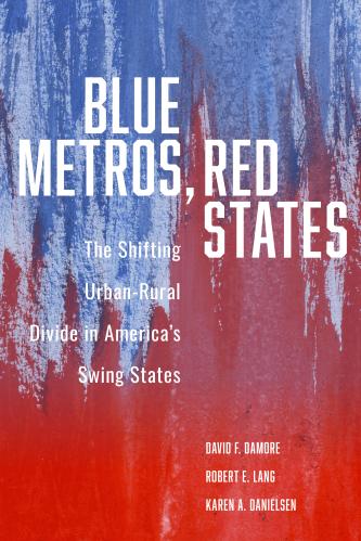
Today, based on analysis in our book Blue Metros, Red States: The Shifting Urban-Rural Divide in America’s Swing States, a new type of discriminatory line is forming at the regional rather than neighborhood level. We label these “bluelines” to delineate the demographic, economic, geographic, and political divisions between blue, Democratic-leaning, million-plus metropolitan areas from the rest of their more Republican-dominated red states. In addition to considering how the twenty-seven metros in the thirteen swing states covered in our book affect electoral outcomes, we show how tensions between big metros and the balance of their states animate intrastate political and policy conflicts between the two.
Examples of bluelining highlighted in our book include the Georgia “fetal heartbeat” and North Carolina “bathroom” laws, which were imposed by state legislatures on metros such as Atlanta, Charlotte, and Raleigh. These bills damaged industries in both states—film and television production in Georgia and pharmaceutics in North Carolina—and demonstrate how gerrymandering of legislative districts that overrepresent rural constituencies at the expense of urban interests distort policy agendas. Other forms of bluelining we identify are limited home rule authority[1] and aggressive state preemption[2] that constrain metros’ capacities to chart their own courses, as well as the siphoning of tax revenue generated in million-plus metros to support government services elsewhere. Also note that because many major metros constitute large shares of their state populations, millions of Republicans living in such places are subject to bluelining and its negative impact on metro constituencies.
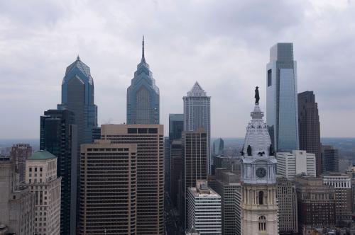
Pennsylvania, which prognosticators expect could be the “tipping point” state that will provide either Donald Trump or Joe Biden with a majority of Electoral College votes, exemplifies the politics of bluelining. In fact, the Keystone State’s blueline is so well established that it is featured on a tee shirt depicting to “Make Pennsylvania Great Again” by “Build[ing] a Wall” around metro Philly.
Philadelphia’s “otherness” relative to the rest of Pennsylvania is not just a consequence of the density and diversity that underlies its strong Democratic voting, but also stems from its socio-cultural connection to the liberal Northeast Corridor that runs along the Eastern Seaboard from Boston to Washington. Consequently, Philadelphia’s politics more closely align with Mid-Atlantic states such as Delaware, Maryland, New Jersey, and New York. Without Philadelphia, Pennsylvania would be a red state, rather than a swing states. By contrast, central and western Pennsylvania are demographically and culturally similar to the Midwest. Consider that Pittsburgh is one of the largest Republican-leaning metropolitan areas in the country. In 2012, Mitt Romney carried it by two points. Four years later, Donald Trump’s 59,000 vote advantage in the region exceeded his statewide margin of victory.
The demographic, political, and cultural differences between Philadelphia and Pittsburgh are at odds with the long-held notion that Pennsylvania’s two major metros differ from its rural central section, what is known pejoratively as “Pennsyltucky” (a portmanteau of Pennsylvania and Kentucky) or what James Carville once described as “Alabama without the Blacks.” Rather, the state’s politics are now being shaped by an emerging east/west division.
The 2019 county elections are indicative of these shifting dynamics. The Democrats won all seats on the Delaware County Commission in suburban Philadelphia for the first time since the Civil War. The party also gained commission majorities in Bucks and Chester, two other Philadelphia metro collar counties. Just recently, The Morning Call ran a story with the headline: “Disgusted voters in Philadelphia suburbs could help Biden offset Trump’s gains in Pennsylvania.” Meanwhile, in 2019, Republicans in western Pennsylvania won a majority of seats on the Washington County commission for the first time in decades.
More generally, the shifts occurring in Pennsylvania are consistent with our book’s thesis that the denser and more diverse the locality and the more proximate a place is to the metropolitan center, the greater the Democratic support. While these effects are more apparent in the Sun Belt’s fast-growing and urbanizing suburbs, they can also be seen in the Northeast Corridor. For instance, Census data analyzed by Brookings demographer William Frey shows that between 2000 and 2019, metro Philadelphia, which encompasses parts of Pennsylvania, Delaware, New Jersey, and Maryland, grew by more than 130,000 people even as the number of whites decreased by more than 150,000. Conversely, Frey finds that metro Pittsburgh shrunk by roughly 40,000 residents and its white population decreased by over 80,000.
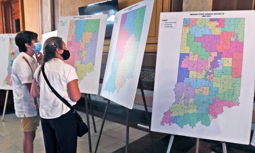
Even as Philadelphia grows, the institutional structures in Pennsylvania limit the city’s ability to control its own destiny. Pennsylvania has one of the lowest local government autonomy rankings in the country. Pennsylvania’s state government has preempted local authority in a number of policy areas including gun safety, minimum wage, ride sharing, and broadband. Philadelphia’s ability to develop and implement a metro-scale policy agenda is hindered by the region’s municipal fragmentation, which disperses power across more than two hundred local governments, each with its own constituencies and interests. Moreover, during the 2011 legislative sessions, Republicans used their unified control of state government to aggressively gerrymander Pennsylvania’s U.S. House and state legislative districts, provoking legal challenges to both sets of maps. After the Pennsylvania Supreme Court ruled the U.S. House maps unconstitutional and ordered new maps drawn, the Democrats gained one seat in the state’s congressional delegation in the 2018 midterm elections.
Still, despite these and other obstacles, metro Philadelphia—and most other million-plus metros—continue to succeed in the face of bluelineing. Imagine how much more could be achieved if these metros did not have to fight so many red state roadblocks.
Robert Lang is the Lincy Endowed Chair in Urban Affairs at UNLV’s Greenspun College of Urban Affairs. He is also the Executive Director of Brookings Mountain West and The Lincy Institute. David Damore is a Professor and Chair in Political Science at UNLV. He is also a Non-Resident Senior Fellow at the Brookings Institution in Washington, DC. Karen Danielsen is an Associate Professor in Public Policy and Leadership at UNLV. Their new book Blue Metros, Red States is available from the Brookings Institution Press.
[1] Home rule establishes the level of authority that is afforded to local governments by either a state’s constitution or in statute.
[2] Preemption occurs when state governments pass laws that eliminate local control over a particular policy area. A recent analysis by the National League of Cities reports an increase in preemption, particularly in states where Republicans control both chambers of the statehouse and the governorship.
The Brookings Institution is committed to quality, independence, and impact.
We are supported by a diverse array of funders. In line with our values and policies, each Brookings publication represents the sole views of its author(s).




Commentary
The new politics of bluelining
October 7, 2020