
Contents
- The limitations of traditional food access analysis
- The reality of food insecurity in America
- Building a 21st century food security program
- Conclusion
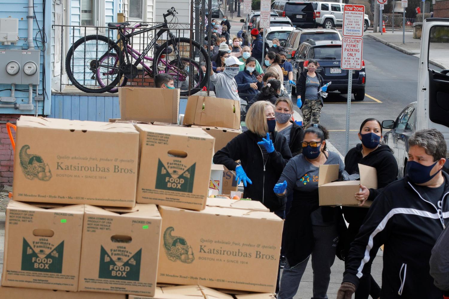
The COVID-19 pandemic shined a spotlight on the shortcomings within the country’s social safety net— especially in the case of food security. The drastic rise in unemployment, lost access to school meals, and volatile food supply chains all contributed to food insecurity rates doubling among all households from February 2020 to May 2020. Even worse, food insecurity among households with children tripled in the same period.
While many Americans became aware of the country’s food insecurity issues in the past year, the phenomenon was not new. Even in 2019—before the pandemic and after years of steadily declining food insecurity rates—10.5% of U.S. households still faced food insecurity. This rate was highest among households with incomes below the poverty line (34.9%) and single-mother households (28.7%). Latino or Hispanic and Black households experienced food insecurity rates of 15.6% and 19.1%, respectively—disproportionately higher than white households (7.9%).
Why, even outside of economic crisis, do over one in 10 families still face food insecurity?
For decades, academics, advocates, and policymakers pointed to unequal geographic access to food as the problem. This geographic focus eventually gave rise to the concept of the “food desert”—a shorthand description for how a lack of fresh food retailers can predispose neighborhood residents to food insecurity. The concept resonated with the media and practitioners, giving rise to new indices and a push to bring fresh food directly to underserved neighborhoods.
However, there are structural issues with the food desert concept. For one, most people shop beyond their neighborhood for food. Food deserts also don’t consider digital delivery services, which reduce the relative importance of one’s physical location. But maybe more importantly, the food desert narrative doesn’t address the primary factor driving food insecurity: financial insecurity.
With food insecurity once again top of mind, it’s an ideal time to update the concept of geographic food access for today’s digital economy and consider policies that will marry the need to increase people’s buying power with their ability to get the food they need.
The limitations of traditional food access analysis
Since the 1990s, most food access literature has been framed around the popular term “food desert,” defined in the 2008 Farm Bill as an “area in the United States with limited access to affordable and nutritious food, particularly such an area composed of predominantly lower-income neighborhoods and communities.”
While scholars have proposed myriad ways of identifying these areas, a representative case is the U.S. Department of Agriculture’s (USDA) Food Access Research Atlas, formerly the Food Desert Locator. This interactive tool highlights census tracts below certain income, supermarket proximity, and vehicle access thresholds. Others have attempted to refine food access metrics by incorporating transit, bicycle, and walking thresholds; measuring travel time, price distance, or network (street) distance rather than traditional Euclidian distance; and adding temporal data such as transit and store schedules or more nuanced socioeconomic indicators.
Such research has drawn critical links between neighborhood-level food access, legacies of redlining and segregation, and the role of structural racism in the built environment and food system. Yet, as noted in more recent literature, the deficit-focused food desert narrative is still hindered by technical limitations and false assumptions about how people navigate the modern food environment.

Underlying nearly all food access mapping is the assumption that individuals prefer to shop at the food retailer closest to their home. But research into food shopping behavior has shown that assumption to be false. A 2015 analysis of National Household Food Acquisition and Purchase Survey data found that the average American household does not shop for food at the retailer closest their home, instead bypassing it for a preferred store further away. Another study concluded that the average distance to shoppers’ preferred supermarket was greater than the distance to the closest supermarket—both for shoppers with and without vehicles. A 2009 study by the USDA Economic Research Service also found enormous diversity in food shopping behavior, noting those living in low-income, low-access areas were more likely to shop for food near their workplace than their home. This access strategy—bundling multiple errands into a single excursion, or “trip chaining”—is overlooked by traditional food access mapping and analysis.
Traditional food access mapping also tends to overlook community-driven food security strategies. Many communities increase healthy food access through small grocers, community and school gardens, farmers’ markets, and other methods ignored in the classification of food deserts. More detailed investigations—such as a 2007 study of the San Francisco Bay Area and a 2015 study of Detroit—find that communities without supermarkets often have these kinds of alternative healthy food procurement networks.
Technical limitations can also distort traditional food access mapping. Food desert analyses tend to strictly define a community’s socioeconomic and food establishment conditions by what’s within the formal borders, whether it be a census tract, municipality, or county. However, people’s perception of their neighborhood and food environment don’t fit perfectly within externally drawn lines. To put it simply, nobody considers whether they are crossing a boundary while traveling to the grocery store. Exacerbating the issue is that food retailers tend to choose locations directly adjacent to busy and easily accessible roads, which often run along census tract and other geographic boundaries; thus, residents in a tract with no grocery store may actually live directly across the street from one. While researchers can dull the effects of this technical limitation—formally termed the “edge effect”—by constructing buffers and catchments around areas of study, the most widely shared food access maps and narratives rely on more basic (and less accurate) methods.

The way we choose to navigate the built environment is constantly changing, but food access analysis is not keeping up. The share of national retail sales conducted through e-commerce has been steadily increasing over the past 20 years, and that includes buying food. A Pew Research Center survey found that during the COVID-19 pandemic, nearly one-third (32%) of U.S. adults ordered food online or through an app from a local restaurant, and 21% ordered groceries online or through an app from a local store. The SNAP Online Purchasing Pilot also recently expanded to 48 states, growing alongside the online grocery industry. Despite the potential for online food shopping to increase food access, traditional food access maps omit this option.
The reality of food insecurity in America
The food desert narrative got America talking about the important connection between geography and the food system. The concept also raised awareness about how systemic racism impacts access, including the persistent effects of redlining (including supermarket redlining) on communities across the country. While such communities use a variety of resilient and adaptive food security strategies, physical and geographic food access barriers can have a prohibitive effect on food security for some individuals, especially the elderly and those with disabilities.
But food deserts are a red herring in terms of ending food insecurity in the United States. As the USDA stated bluntly in a 2014 study of Supplemental Nutrition Assistance Program (SNAP) participants: “Geographic access to food was generally not associated with the percentage of households that were food insecure.”
Even with perfect, universal access to food retailers, millions of Americans would not be able to afford enough food, or enough of the kinds of food, to meet their household’s needs. The food desert narrative overlooks the basic relationship between supply and demand; increasing the supply of food will only increase consumption if there is enough demand to meet it. In the case of food, demand is suppressed among lower-income households. Low-income households spend less than a third of what high-income households spend on food each year, yet food expenditures account for a disproportionate share (36%) of their disposable income. This forces families to make impossible decisions between food and medicine, heating and cooling, housing, and education.

The lack of available income only serves to limit the benefits of supply-oriented solutions. For example, the Healthy Food Financing Initiative is a public-private partnership to incentivize grocers to locate in low-access areas, increasing convenience of access and bringing more jobs to these communities. But adding another grocer to a designated food desert will not address limited income, only reduce travel times.
Instead, upstream antipoverty and social safety net policies address limitations in demand, empowering people to access and purchase the food they need in the ways that work best for them. SNAP supports low-income households through a monthly benefit based on income and household size. This highly effective program directly increases household buying power, leading to increased food spending and food security. Increased SNAP benefits, such as the implementation of Pandemic EBT over the past year, have a strong positive impact on food security. More broadly, increasing incomes and financial security increases food security.
These programs are only insufficient when they are too small; households often run out of SNAP benefits by the end of the month. Barriers such as work requirements, the chilling effects of the Trump administration’s public charge immigration rule (now rescinded), and time-intensive application processes mean that not all food insecure households are able to take advantage of the program.
Data from the past year only confirms the power of increased, flexible income to meet household needs. Timely data from the Census Bureau’s Household Pulse Survey demonstrates the continued demand for—and impact of—the first wave of Child Tax Credit (CTC) payments for American households. Households that spent their first CTC payment tended to spend it on food, and food insufficiency (comparable to very low food security) rates among respondents dropped 3% immediately after the first wave of CTC payments was dispersed.

Building a 21st century food security program
Even with prevailing challenges to current food desert practices, geography is still an important component of food insecurity. A community can be healthier if there are more private and civic food distributors within a reasonable travel distance and if community members can afford to patronize them. Neighborhood residents can benefit from emerging delivery services if they’re within delivery service areas and broadband is available and affordable. Offering more affordable transportation services, especially for low-income households, can facilitate trips to people’s preferred food establishments.
As federal, state, and local practitioners pursue more impactful food insecurity policies, the following framework can address some of the remaining structural barriers to food security.
Measurement
Significant measurement gaps are still holding back our understanding of food geographies in the U.S. Notably, the nearly decade-old 2012 Food Acquisition and Purchase Survey is the only nationally representative dataset to ever track how households acquire (purchase or otherwise) food over the course of a week. Data from this and smaller local surveys underly much of the research calling into question common food desert assumptions. A second wave of the Food Acquisition and Purchase Survey is currently underway and should better reflect the modern food environment, although other data gaps still need to be addressed.
Measuring and mapping resilient community food access assets—rather than just “naming and shaming” communities with low supermarket access—can support more diverse food access strategies. Academics and community organizations have explored the use of participatory mapping techniques to empower communities to share their local knowledge of food landscapes. In one study, researchers employed “critical cartography, counter-mapping, community asset mapping, participatory geographic information systems, and radical cartography” to map the Providence, R.I. food environment. The resulting map shows a dynamic “food topography” including both the “valleys” and “peaks” of local food access—a community-driven narrative absent from other maps. Another study found that participatory mapping techniques not only revealed insights overlooked by traditional public health analyses, but that the mapping process itself informed and supported local policy advocacy efforts.
While participatory mapping can be more time- and resource-intensive than traditional food access analyses, the benefits are substantial and can be scaled using emerging best practices, including the International Fund for Agricultural Development’s “Good practices in participatory mapping.” The USDA should use pilots conducted with local partners to test which participatory mapping practices could scale to all communities.
Data on broadband and food delivery zones also constitute a significant measurement gap. The Federal Communications Commission (FCC) is currently implementing the 2020 Broadband DATA Act to provide more accurate and complete information on network availability across the country, but most localities do not yet have granular data on the prices, speeds, availability, and barriers to broadband adoption in their community.
And while the SNAP Online Purchasing Pilot (OPP) is growing alongside the increase in online food ordering across the economy, our understanding of the online delivery food landscape is remarkably limited. The Economic Research Service estimated that by June 2020, over 90% of SNAP participants lived in states where the SNAP OPP was available, and that share can only have increased as the 39 participating states grew to 48 by March 2021. Yet delivery zones are determined at an establishment level, and none of the major retailers included in the pilot have publicly available delivery zone data. Early in the pilot, researchers manually searched retailer websites for delivery availability by ZIP code for eight states, but this method is unsustainable considering the rapidly growing and changing grocery delivery environment.
As online ordering becomes an increasingly common food access strategy, broadband and delivery zone data will be an important factor in understanding the geography of online food access. The FCC could work with the USDA to test new digital delivery pilots, such as merging eRate practices (broadband programs targeting schools and libraries) and the new Emergency Broadband Benefit (broadband discounts for income-qualifying households) to focus on food insecure households with children.
Modernization
To keep pace with the evolving food environment, nutritional assistance policy needs a refresh. The growth of the SNAP OPP shows the potential of modern, flexible approaches that support low-income households in a variety of food shopping strategies. Yet the program is still limited to a subset of the many retailers and food types available to American consumers through direct and third-party online purchasing systems. Online purchasing is a new and exciting direction for nutritional assistance policy in the U.S., but the system is also overdue for more fundamental modernization.
For instance, past research has found a significant link between local food prices and food insecurity rates among SNAP participants. In areas with higher food prices and higher costs of living, low-income individuals are more likely to be forced into impossible choices between essentials like food, medicine, housing, and utilities. However, SNAP benefits are calculated using income and household size formulas; benefits are not adjusted for regional cost of living and food price.
A quick glance at the Feeding America’s Map the Meal Gap tool reveals troubling disparities in how far SNAP budgets can stretch. In Willacy County, Texas, for example, the average meal cost is $2.24; but in Washington, D.C. the average meal costs $4.35.
Currently, maximum SNAP benefits are based on the nationally averaged cost of the Thrifty Food Plan, a set of market baskets originally created in 1961 that include common and affordable groceries. The plan recently received a much-needed update to account for changing food prices, nutritional guidance, and food preferences, resulting in a historic increase in SNAP benefit levels. Despite these updates, the cost of the Thrifty Food Plan is still required by law to remain equal across the contiguous 48 states. With the notable exceptions of Alaska, Hawaii, Guam, and the U.S. Virgin Islands, the use of a single average cost to determine SNAP benefits across the country ignores dramatic food price variation households face, and leaves households in high-cost areas with significantly less support in the face of food insecurity. The Thrifty Food Plan also fails to account for other geographically varying costs associated with acquiring food, such as transportation or delivery fees. The process for determining SNAP benefit levels is in urgent need of modernization to better reflect the country’s economic, dietary, and geographic diversity.
In addition to modernizing our country’s fundamental nutritional assistance programs, policymakers should scale support for successful community-driven food security strategies to promote not just food security, but food justice. Programs such as the Senior Farmers’ Market Nutrition Program increase buying power among low-income elders and support resilient local food systems and healthy food access in tandem. Other programs, including Double Up Food Bucks and the Connecticut Fresh Match Program, multiply SNAP’s impact at farmers’ markets, again simultaneously supporting demand and local supply of healthy foods.
These programs address food security by increasing access, supply, and buying power—but they also refocus local food narratives on resilience and community power. Information gathered during participatory community food mapping can be used to scale these community-driven food security strategies and test new ones.
Conclusion
Food insecurity is a persistent problem in our country, and structural inequalities increase its prevalence in certain populations and geographies. Singling out neighborhoods without grocery stores as “food deserts” has failed to produce a successful solution. But lessons can be drawn from decades of food access analysis to inform new methods to better measure the geography of food insecurity in the United States, and modernize our country’s nutritional assistance policies.
Related Content


Authors