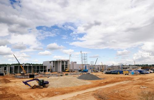
The Washington, D.C. metro area needs to build more housing. Over the past 30 years, housing construction in the region has barely kept pace with population and job growth, while housing prices have grown faster than household incomes. Worsening housing affordability makes it harder for employers to attract and retain workers, threatening regional productivity. In 2019, the Metropolitan Washington Council of Governments issued a report stating that the region needs to add 320,000 more housing units between 2020 and 2030, and that at least 75% of this new housing should be affordable to low- and medium-income households.
Why hasn’t housing supply in the Washington, D.C. metro area kept up with demand? How much of the shortfall is due to market factors, and how much reflects policy choices of local governments? Research shows that zoning laws impede housing construction in high-priced neighborhoods. Conversely, some advocates argue that there is simply not enough land available, and many communities are already “built out.”
To gain insight into this question, this piece looks at how land across the metro area is currently being used. The National Land Coverage Database (NLCD) provides data generated via satellite pictures that categorize land use patterns for the entire country. The raw images are divided into 30-meter-by-30-meter grid squares, each of which is then categorized by a machine learning algorithm into one of 16 categories which detail level of development or usage of land.
How the capital region’s land is being used
As an example of how the satellite images categorize land use, here is what the NLCD shows for the Wheaton Metro Station in Montgomery County, Md.

Each red dot marks the middle of a grid square. A one acre plot would have just over four grid squares to it. All eight squares in the Wheaton Metro Station parcel are classified as “Developed, High Intensity,” an accurate characterization of this densely built area.
Let’s zoom out and see how the algorithms describe Ronald Reagan Washington National Airport in Arlington, Va.

Most of the land surrounding the airport is also categorized as “Developed, High Intensity.” The landing strips, however, are categorized as “Developed, Very Low Intensity.” This highlights an important caveat of using this data for inference about whether and where to develop: Just because an area is categorized as “very low intensity” does not mean that it has the potential to be developed further.
Over large geographic stretches, though, the satellite data still gives a reasonable sense of density patterns. From there, with the help of contextual knowledge, we can glean insights into where the potential for further housing exists.
The District of Columbia doesn’t have much undeveloped land
Looking at the city level shows that the District of Columbia has very little undeveloped land, except for established parks. The District’s characteristic rowhouses make up much of the medium-intensity developed (orange) swaths, with roughly 10 rowhouses to an acre. High-intensity areas (red) include dense commercial areas such as downtown, the federal buildings south of the National Mall, and Union Station. Mixed residential-commercial areas including the Waterfront, Navy Yard, and H Street, Northeast also show up as high-intensity.

The green areas (indicating undeveloped land) are mostly parks, including the National Mall, Rock Creek Park, the National Arboretum, and Glover Park. Once those areas are all accounted for, very little undeveloped land is left. The most noticeable patches of very-low-intensity (pale pink) to low-intensity (peach) development can be found in Northwest DC, along the Maryland border. There are some low-intensity (peach) pockets east of the Anacostia River as well.
The region has lots of undeveloped land—but we don’t know if it’s available for housing
Although the District has little undeveloped land, the capital region overall has quite a lot. The jurisdictions in the region’s inner core (the District, Arlington, and Alexandria, Va.) have the least undeveloped land and the most high-density development. This bears out a key theory of urban economics: Land values tend to be higher near job centers, encouraging higher-density development on that land.

The chart makes it clear that we should not overlook the suburbs and exurbs when thinking about the capital region’s housing shortage. More than seven in 10 regional residents live in Fairfax, Montgomery, or Prince George’s counties. Even with that, more than two-thirds of the land in these three counties is undeveloped or very-low-density development.
Much of the existing open space in Montgomery County and Prince George’s County has been designated as agricultural reserves, and therefore is off-limits to development. But even excluding agricultural reserves, the larger suburban and exurban jurisdictions have substantial areas that could accommodate housing development.
Satellite data can inform planning decisions, but must be supplemented by local knowledge
The land use patterns revealed by satellite data provide useful insights into the region’s current development patterns, but can’t answer all our questions. For one, the data doesn’t allow us to distinguish between residential and nonresidential development. And it doesn’t indicate whether zoning or other legal and political barriers effectively limit development of open space or low-intensity areas (for instance, if rowhouse blocks could be redeveloped into larger apartment buildings).
The NLCD is a valuable tool that—when used in combination with other publicly available datasets—can help determine the region’s capacity to accommodate more housing. Environmental advocates may balk at the idea of converting green space into high-density housing. And people who live in low-density residential neighborhoods frequently invoke “Manhattanization” to dissuade efforts to add new housing—as if housing typologies are restricted to either single-family homes or skyscrapers.
In reality, there are plenty of options to add housing through gradual increases in density, allowing rowhouses, duplexes, and low- to mid-rise apartment buildings to be interspersed with single-family detached homes. Any meaningful attempt to increase housing supply and bring down housing costs in the Washington, D.C. region will require a strategic combination of all of these options.
Related Content

Authors


Commentary
The Washington, DC region needs more housing, and satellite data can tell us where to build
June 4, 2020